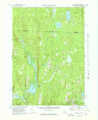
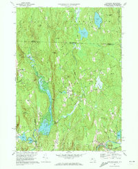
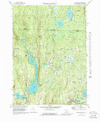
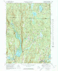
1971 Map of Royalston
USGS Topo · Published 1978About this map
The town of Royalston and its outlying hamlets occupy a landscape of steep hills and winding brooks along the border of Massachusetts and New Hampshire. By the early 1970s, the area remained largely rural, defined by the Boston and Maine Railroad corridor following the Millers River through South Royalston. The village center of Royalston is well-preserved, featuring the Center Church, Raymond School, and Center Cemetery. To the south, the impact of mid-century water management is evident at Tully Dam, which regulates the waters of Tully Lake and Long Pond. These reservoirs, along with Tully Pond and Little Tully Pond, dominate the southwestern quadrant. Genealogists will find interest in several historic burial grounds, including the Chestnut Hill Cemetery and the Riverside Cemetery, which serve as quiet markers of the region's long-established family lineages and local history.
Find a feature on this map
76 named features on this map. Tap any name to fly to it.
Don’t see what you’re looking for? This feature index may not catch every label — zoom into the map to look around manually.
Map Details
Editions of this 1971 Royalston Map
5 editions found

Other maps of this area

1887 · Warwick
USGS Topo · 1:62,500

1887 · Winchendon
USGS Topo · 1:62,500

1889 · Warwick
USGS Topo · 1:62,500

1890 · Winchendon
USGS Topo · 1:62,500

1894 · Winchendon
USGS Topo · 1:62,500

1894 · Warwick
USGS Topo · 1:62,500

1898 · Monadnock
USGS Topo · 1:62,500

1898 · Keene
USGS Topo · 1:62,500

1932 · Warwick
USGS Topo · 1:48,000

1932 · Winchendon
USGS Topo · 1:48,000