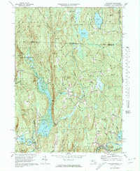
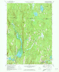
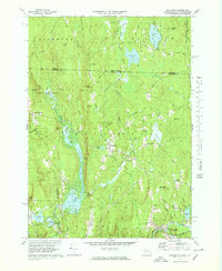
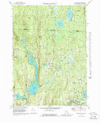
1971 Map of Royalston
USGS Topo · Published 1981About this map
The Tully River and its accompanying wetlands dominate this northern Worcester County landscape, creating a distinct north-south corridor of water and forest. Centered on the village of Royalston, the area is characterized by scattered upland settlements like West Royalston and Packard Heights connected by a network of rural roads including the Old Turnpike Road. The map documents the localized concentration of civic life at the village center, where the Raymond Sch and Center Cem are situated, contrasted with the industrial and transit corridor to the south where the Boston and Maine railroad follows the path of the Millers River through South Royalston. Elevation changes across the terrain are punctuated by landmarks such as Tully Mtn and Frye Hill, while the rugged hydrology of the region is evident in the presence of Donne Falls and Spirit Falls along the river's descent toward the Athol border.
Find a feature on this map
66 named features on this map. Tap any name to fly to it.
Don’t see what you’re looking for? This feature index may not catch every label — zoom into the map to look around manually.
Map Details
Editions of this 1971 Royalston Map
5 editions found

Other maps of this area

1887 · Warwick
USGS Topo · 1:62,500

1887 · Winchendon
USGS Topo · 1:62,500

1889 · Warwick
USGS Topo · 1:62,500

1890 · Winchendon
USGS Topo · 1:62,500

1894 · Winchendon
USGS Topo · 1:62,500

1894 · Warwick
USGS Topo · 1:62,500

1898 · Monadnock
USGS Topo · 1:62,500

1898 · Keene
USGS Topo · 1:62,500

1932 · Warwick
USGS Topo · 1:48,000

1932 · Winchendon
USGS Topo · 1:48,000