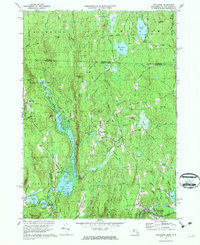
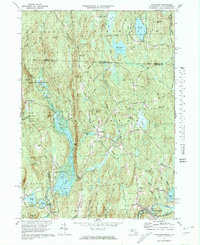
1971 Map of Royalston
USGS Topo · Published 1988About this map
Royalston serves as the focal point of this northern Worcester County landscape, situated where the terrain drops toward the Millers River valley. The map documents a period of significant water management and recreation, highlighted by the Tully Dam and the sprawling waters of Long Pond and Tully Pond. These features, alongside Doane Falls and Spirit Falls, illustrate the area's transition from a mill-driven economy to one focused on conservation and public lands like the Royalston State Forest.
Find a feature on this map
108 named features on this map. Tap any name to fly to it.
Don’t see what you’re looking for? This feature index may not catch every label — zoom into the map to look around manually.
Map Details
Editions of this 1971 Royalston Map
5 editions found
Other maps of this area

1887 · Warwick
USGS Topo · 1:62,500

1887 · Winchendon
USGS Topo · 1:62,500

1889 · Warwick
USGS Topo · 1:62,500

1890 · Winchendon
USGS Topo · 1:62,500

1894 · Winchendon
USGS Topo · 1:62,500

1894 · Warwick
USGS Topo · 1:62,500

1898 · Monadnock
USGS Topo · 1:62,500

1898 · Keene
USGS Topo · 1:62,500

1932 · Warwick
USGS Topo · 1:48,000

1932 · Winchendon
USGS Topo · 1:48,000