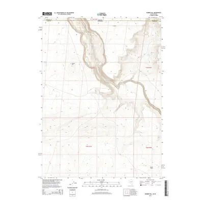
2014 Map of Rubber Hill
USGS Topo · Published 2014About this map
The South Fork Owyhee River carves a winding path through the high desert of Elko County, defining the central drainage of this remote borderland. To the north and south, the terrain transitions into the broad, arid expanses of the Y P Desert and the Owyhee Desert, respectively. The namesake Rubber Hill rises above the western bank, standing near the seasonal waters of Rubber Lake. This landscape is characterized by its isolation and the deep canyon topography of the river, which serves as the primary geographic focal point in a region dominated by vast open plateaus and desert sage. The map also captures the intersection of state and county lines, marking where the high plateau of Nevada meets the Idaho border, a point of interest for those tracking historical land surveys and geopolitical boundaries in the Great Basin.
Find a feature on this map
13 named features on this map. Tap any name to fly to it.
Don’t see what you’re looking for? This feature index may not catch every label — zoom into the map to look around manually.
Map Details
Editions of this 2014 Rubber Hill Map
This is the sole edition of this map. No revisions or reprints were ever made.
Other maps of this area

1955 · McDermitt
USGS Topo · 1:250,000

1955 · Jordan Valley
USGS Topo · 1:250,000

1957 · Jordan Valley
USGS Topo · 1:250,000

1958 · Jordan Valley
USGS Topo · 1:250,000

1959 · McDermitt
USGS Topo · 1:250,000

1973 · Coyote Hole
USGS Topo · 1:24,000

1973 · Bull Camp Butte
USGS Topo · 1:24,000
1973 · Star Valley Ridge East
USGS Topo · 1:24,000
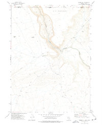
1973 · Rubber Hill
USGS Topo · 1:24,000

1973 · Twelvemile Flat
USGS Topo · 1:24,000