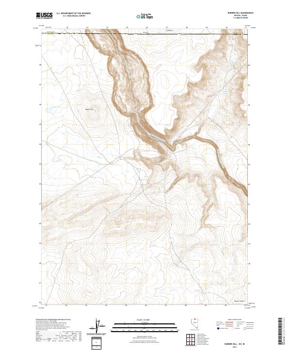
2021 Map of Rubber Hill
USGS Topo · Published 2021About this map
The South Fork Owyhee River carves a deep, winding canyon through the high desert borderlands of Nevada and Idaho. This high-altitude landscape is defined by its arid plateaus, where Rubber Hill stands as a prominent topographical feature overlooking the seasonal Rubber Lake. The map details the transition between the Y P Desert to the north and the Owyhee Desert to the south, highlighting the isolation of the Great Basin's northern reaches. Natural water sources like Coyote Springs provide critical points of reference in an area otherwise dominated by volcanic terrain and steep canyon walls, illustrating the precariousness of life and travel in this remote corner of Elko County.
Find a feature on this map
15 named features on this map. Tap any name to fly to it.
Don’t see what you’re looking for? This feature index may not catch every label — zoom into the map to look around manually.
Map Details
Editions of this 2021 Rubber Hill Map
This is the sole edition of this map. No revisions or reprints were ever made.
Other maps of this area

1955 · McDermitt
USGS Topo · 1:250,000

1955 · Jordan Valley
USGS Topo · 1:250,000

1957 · Jordan Valley
USGS Topo · 1:250,000

1958 · Jordan Valley
USGS Topo · 1:250,000

1959 · McDermitt
USGS Topo · 1:250,000

1973 · Coyote Hole
USGS Topo · 1:24,000

1973 · Bull Camp Butte
USGS Topo · 1:24,000
1973 · Star Valley Ridge East
USGS Topo · 1:24,000
1973 · Rubber Hill
USGS Topo · 1:24,000

1973 · Twelvemile Flat
USGS Topo · 1:24,000