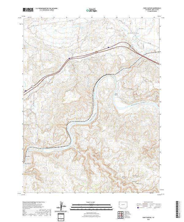
2022 Map of Ruby Canyon
USGS Topo · Published 2022About this map
The Colorado River carves a deep, winding path through this corner of the Grand Valley, defining a landscape of high desert drainage and dramatic geology. The river's course creates distinct riparian zones such as Crow Bottom and Moore Bottom, while the surrounding plateaus are incised by steep-walled features like Horsethief Canyon and the namesake Ruby Canyon. The upland terrain is characterized by a dense network of recreational routes, including the Kokopelli Trl and various family-named trails like Rabbit's Ear Trl.
Find a feature on this map
44 named features on this map. Tap any name to fly to it.
Don’t see what you’re looking for? This feature index may not catch every label — zoom into the map to look around manually.
Map Details
Editions of this 2022 Ruby Canyon Map
This is the sole edition of this map. No revisions or reprints were ever made.
Other maps of this area

1885 · East Tavaputs
USGS Topo · 1:250,000

1956 · Westwater 4 SE
USGS Topo · 1:24,000

1956 · Grand Junction
USGS Topo · 1:250,000

1959 · Grand Junction
USGS Topo · 1:250,000

1960 · Grand Junction
USGS Topo · 1:250,000

1962 · Grand Junction
USGS Topo · 1:250,000

1962 · Mack
USGS Topo · 1:24,000
1962 · Battleship Rock
USGS Topo · 1:24,000

1964 · Grand Junction
USGS Topo · 1:250,000

1965 · Grand Junction
USGS Topo · 1:250,000