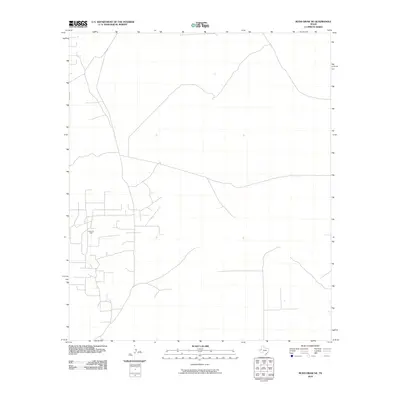
2010 Map of Rudd Draw NE
USGS Topo · Published 2010About this map
Grice Oil Field defines the industrial footprint of this Loving County landscape, where the extraction of natural resources shapes the local infrastructure. The road network on this portion of the Rudd Draw NE quadrangle reveals a complex pattern of access paths and service routes typical of West Texas energy development. While the terrain is characterized by subtle elevation changes, the primary human presence is marked by these industrial corridors rather than traditional residential settlements, reflecting the era’s intensive focus on petroleum production in the Permian Basin region.
Find a feature on this map
2 named features on this map. Tap any name to fly to it.
Don’t see what you’re looking for? This feature index may not catch every label — zoom into the map to look around manually.
Map Details
Editions of this 2010 Rudd Draw NE Map
This is the sole edition of this map. No revisions or reprints were ever made.
Other maps of this area

1954 · Hobbs
USGS Topo · 1:250,000

1954 · Pecos
USGS Topo · 1:250,000

1957 · Pecos
USGS Topo · 1:250,000

1958 · Hobbs
USGS Topo · 1:250,000

1961 · Lindley Ranch
USGS Topo · 1:24,000

1969 · Kyle Ranch
USGS Topo · 1:24,000

1969 · Cheyenne Draw SW
USGS Topo · 1:24,000

1969 · Rudd Draw NE
USGS Topo · 1:24,000
1969 · Rudd Draw
USGS Topo · 1:24,000

1970 · Brunson Ranch
USGS Topo · 1:24,000