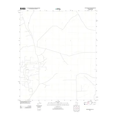
2012 Map of Rudd Draw NE
USGS Topo · Published 2012About this map
Grice Oil Field dominates the central-western portion of this West Texas landscape, illustrating the industrial footprint of petroleum extraction in one of the nation's least densely populated regions. Located in Loving County, the map reveals an extensive network of service roads and well pads required for energy production during the early 21st century. Apart from these industrial developments, the terrain remains largely open, marked by sparse drainage patterns and the path of Co Rd 2. This survey provides a distinct record of how modern energy infrastructure overlays the arid Texas landscape, providing specific locations for oil and gas industry historians or those researching the development of regional mineral interests.
Find a feature on this map
2 named features on this map. Tap any name to fly to it.
Don’t see what you’re looking for? This feature index may not catch every label — zoom into the map to look around manually.
Map Details
Editions of this 2012 Rudd Draw NE Map
This is the sole edition of this map. No revisions or reprints were ever made.
Other maps of this area

1954 · Hobbs
USGS Topo · 1:250,000

1954 · Pecos
USGS Topo · 1:250,000

1957 · Pecos
USGS Topo · 1:250,000

1958 · Hobbs
USGS Topo · 1:250,000

1961 · Lindley Ranch
USGS Topo · 1:24,000

1969 · Kyle Ranch
USGS Topo · 1:24,000

1969 · Cheyenne Draw SW
USGS Topo · 1:24,000

1969 · Rudd Draw NE
USGS Topo · 1:24,000
1969 · Rudd Draw
USGS Topo · 1:24,000

1970 · Brunson Ranch
USGS Topo · 1:24,000