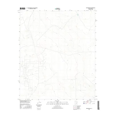
2016 Map of Rudd Draw NE
USGS Topo · Published 2016About this map
Loving County’s arid landscape, captured here in 2014-2015, is defined by an intricate network of local connectors and ranch roads that crisscross the terrain in a grid-like pattern. These roads provide the primary access to the sparse water resources and ranching operations of the West Texas Permian Basin. A prominent water feature is the White Elephant Tank, located in the northeastern portion of the sheet. The terrain’s character is shaped by subtle elevation changes and drainage patterns that reflect the region’s specialized ranching and oil-field infrastructure, where every named landmark like this tank serves as a vital navigational point in an otherwise uniform landscape.
Find a feature on this map
1 named feature on this map. Tap any name to fly to it.
Don’t see what you’re looking for? This feature index may not catch every label — zoom into the map to look around manually.
Map Details
Editions of this 2016 Rudd Draw NE Map
This is the sole edition of this map. No revisions or reprints were ever made.
Other maps of this area

1954 · Hobbs
USGS Topo · 1:250,000

1954 · Pecos
USGS Topo · 1:250,000

1957 · Pecos
USGS Topo · 1:250,000

1958 · Hobbs
USGS Topo · 1:250,000

1961 · Lindley Ranch
USGS Topo · 1:24,000

1969 · Kyle Ranch
USGS Topo · 1:24,000

1969 · Cheyenne Draw SW
USGS Topo · 1:24,000

1969 · Rudd Draw NE
USGS Topo · 1:24,000
1969 · Rudd Draw
USGS Topo · 1:24,000

1970 · Brunson Ranch
USGS Topo · 1:24,000