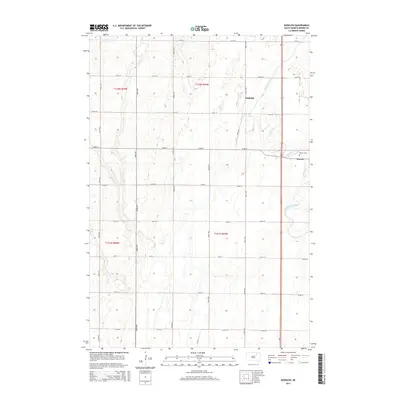
2015 Map of Rudolph
USGS Topo · Published 2015About this map
The settlement of Warner and the nearby village of Rudolph anchor this 2015 study of Brown County, where the agricultural grid of South Dakota meets the winding path of Moccasin Creek. The landscape is defined by the Public Land Survey System, with township boundaries like t121n r64w and t122n r64w organizing the flat prairie into productive sections. Local history is grounded at the Warner Cemetery, which sits just northeast of the primary town center.
Find a feature on this map
23 named features on this map. Tap any name to fly to it.
Don’t see what you’re looking for? This feature index may not catch every label — zoom into the map to look around manually.
Map Details
Editions of this 2015 Rudolph Map
This is the sole edition of this map. No revisions or reprints were ever made.
Other maps of this area

1895 · Aberdeen
USGS Topo · 1:125,000

1899 · Northville
USGS Topo · 1:125,000

1953 · Warner
USGS Topo · 1:24,000

1954 · Mellette
USGS Topo · 1:24,000

1954 · Aberdeen
USGS Topo · 1:250,000

1956 · Aberdeen
USGS Topo · 1:250,000
1960 · Aberdeen East
USGS Topo · 1:24,000

1960 · Aberdeen West
USGS Topo · 1:24,000

1960 · Rudolph
USGS Topo · 1:24,000
1960 · Northville
USGS Topo · 1:24,000