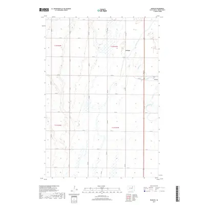
2017 Map of Rudolph
USGS Topo · Published 2017About this map
Moccasin Creek meanders through the eastern plains of Brown County, defining the drainage patterns of this agricultural landscape. The small settlement of Rudolph sits along the rail line, while the town of Warner occupies the southeastern corner of the map. This 2017 edition documents a highly structured grid of section lines and gravel roads, including Co Rd 23 and 386th Ave, which connect the scattered farmsteads of Warner Township. Local history is anchored at the Warner Cem, situated just west of the town center. The map's detailed topography reveals the subtle elevation changes and extensive wetlands that characterize this portion of the James River Valley, providing a clear record of the modern rural infrastructure and land use in the region.
Find a feature on this map
27 named features on this map. Tap any name to fly to it.
Don’t see what you’re looking for? This feature index may not catch every label — zoom into the map to look around manually.
Map Details
Editions of this 2017 Rudolph Map
This is the sole edition of this map. No revisions or reprints were ever made.
Other maps of this area

1895 · Aberdeen
USGS Topo · 1:125,000

1899 · Northville
USGS Topo · 1:125,000

1953 · Warner
USGS Topo · 1:24,000

1954 · Mellette
USGS Topo · 1:24,000

1954 · Aberdeen
USGS Topo · 1:250,000

1956 · Aberdeen
USGS Topo · 1:250,000
1960 · Aberdeen East
USGS Topo · 1:24,000

1960 · Aberdeen West
USGS Topo · 1:24,000

1960 · Rudolph
USGS Topo · 1:24,000
1960 · Northville
USGS Topo · 1:24,000