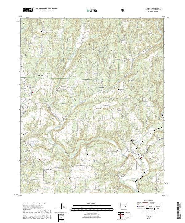
2024 Map of Rudy
USGS Topo · Published 2024About this map
The Ozark National Forest dominates the northern reaches of this landscape, where the rugged terrain of the Boston Mountains transitions into the river valleys of Crawford County. This 2024 survey documents a network of rural settlements including Cedarville, Hobbtown, Figure Five, and the community of Rudy situated along the banks of Frog Bayou. The topography is defined by significant elevations such as Winset Mtn and High Rock Mtn, which overlook the winding paths of East Cedar Creek and Foster Branch. Genealogists will find a high density of burial sites preserved here, ranging from the Spencer Cem in the northwest to the Mount McCurry Cem near the bayou. These numerous family and community cemeteries, including Oliver Cem and Johnson Cem, provide a clear spatial record of early settlement patterns and lineage throughout the hollows and ridge-lines north of the Arkansas River.
Find a feature on this map
121 named features on this map. Tap any name to fly to it.
Don’t see what you’re looking for? This feature index may not catch every label — zoom into the map to look around manually.
Map Details
Editions of this 2024 Rudy Map
This is the sole edition of this map. No revisions or reprints were ever made.
Other maps of this area

1879 · Fort Smith
USGS Topo · 1:62,500

1887 · Van Buren
USGS Topo · 1:62,500

1890 · Fort Smith
USGS Topo · 1:125,000

1898 · Winslow #4
USGS Topo · 1:62,500

1898 · Winslow #3
USGS Topo · 1:62,500

1898 · Winslow
USGS Topo · 1:125,000

1901 · Winslow
USGS Topo · 1:125,000

1906 · Lavaca
USGS Topo · 1:62,500

1943 · Fort Smith
USGS Topo · 1:125,000

1946 · Fort Smith
USGS Topo · 1:250,000