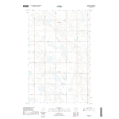
2017 Map of Rugby NE
USGS Topo · Published 2017About this map
Glacial depressions and prairie potholes define this landscape in Pierce County, where water bodies like Sand Lake and Guss Lake are scattered across a strictly organized grid of sections and ranges. The area is partitioned by the township lines of t158n r71w and t157n r71w, showing a rural territory focused on agriculture and land management in the 21st century. Navigated by a network of numbered section-line roads, including 74th St NE and 67th St NE, the map documents the modern drainage patterns and wetland inventories that have shaped this portion of North Dakota. The lack of named settlements emphasizes the open, rural nature of the quadrangle, where the natural hydrology of the plains remains the most prominent feature.
Find a feature on this map
12 named features on this map. Tap any name to fly to it.
Don’t see what you’re looking for? This feature index may not catch every label — zoom into the map to look around manually.
Map Details
Editions of this 2017 Rugby NE Map
This is the sole edition of this map. No revisions or reprints were ever made.
Other maps of this area

1953 · Devils Lake
USGS Topo · 1:250,000

1954 · Rugby NW
USGS Topo · 1:24,000

1955 · Rugby
USGS Topo · 1:24,000

1955 · Rolette SW
USGS Topo · 1:24,000

1956 · Devils Lake
USGS Topo · 1:250,000

1971 · Wolford
USGS Topo · 1:24,000

1971 · Island Lake
USGS Topo · 1:24,000

1971 · Knox
USGS Topo · 1:24,000

1971 · Rugby NE
USGS Topo · 1:24,000
1971 · Pleasant Lake
USGS Topo · 1:24,000