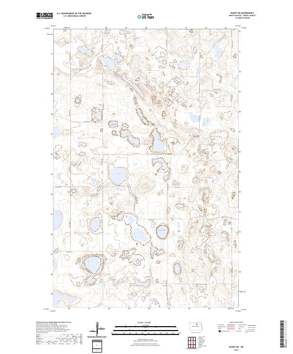
2024 Map of Rugby NE
USGS Topo · Published 2024About this map
Pierce County Waterfowl Production Area dominates this section of the Prairie Pothole Region in Pierce County, where a dense network of wetlands and small water bodies defines the landscape. The terrain is characterized by numerous seasonal and permanent basins, with Sand Lake serving as a primary hydrological feature in the center of the quadrangle. A strict section-line grid of gravel roads, including 38th Ave NE and 70th St NE, organizes the agricultural landscape, illustrating the enduring influence of the Public Land Survey System on North Dakota's rural layout. This 2024 map reflects the modern conservation priorities of the region, where designated production areas provide essential habitat for migratory birds and waterfowl amidst the surrounding farmland of T158N R71W and T157N R70W.
Find a feature on this map
20 named features on this map. Tap any name to fly to it.
Don’t see what you’re looking for? This feature index may not catch every label — zoom into the map to look around manually.
Map Details
Editions of this 2024 Rugby NE Map
This is the sole edition of this map. No revisions or reprints were ever made.
Other maps of this area

1953 · Devils Lake
USGS Topo · 1:250,000

1954 · Rugby NW
USGS Topo · 1:24,000

1955 · Rugby
USGS Topo · 1:24,000

1955 · Rolette SW
USGS Topo · 1:24,000

1956 · Devils Lake
USGS Topo · 1:250,000

1971 · Wolford
USGS Topo · 1:24,000

1971 · Island Lake
USGS Topo · 1:24,000

1971 · Knox
USGS Topo · 1:24,000

1971 · Rugby NE
USGS Topo · 1:24,000
1971 · Pleasant Lake
USGS Topo · 1:24,000