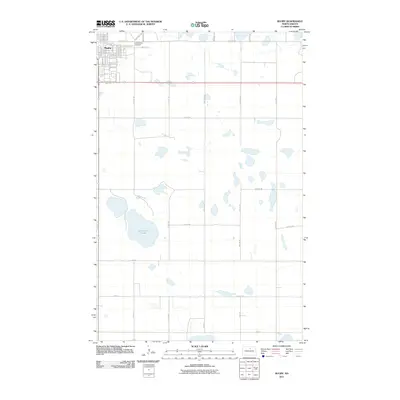
2011 Map of Rugby
USGS Topo · Published 2011About this map
Rugby serves as the focal point of this North Dakota landscape, showing a structured grid of residential streets and industrial corridors as they appeared in 2011. The town's northern edge is defined by Little Flower Cemetery and a transition from urban blocks to the sprawling agricultural sections typical of Pierce County. The presence of Industrial Rd and Western Ave suggests the town's role as a regional center for transit and trade. Beyond the city limits, the terrain is dotted with numerous small wetlands and larger bodies like Gunderson Lake, reflecting the post-glacial prairie pothole geography. A network of section-line roads, such as 61st St NE and 32nd Ave NE, provides access to the surrounding farmland, while Hwy 2 SE cuts across the southern portion of the settlement, linking the community to the wider region.
Find a feature on this map
41 named features on this map. Tap any name to fly to it.
Don’t see what you’re looking for? This feature index may not catch every label — zoom into the map to look around manually.
Map Details
Editions of this 2011 Rugby Map
This is the sole edition of this map. No revisions or reprints were ever made.
Other maps of this area

1953 · Devils Lake
USGS Topo · 1:250,000

1954 · Tunbridge
USGS Topo · 1:24,000

1954 · Rugby NW
USGS Topo · 1:24,000

1954 · Leverich
USGS Topo · 1:24,000

1954 · Minot
USGS Topo · 1:250,000

1955 · Rugby
USGS Topo · 1:24,000

1956 · Devils Lake
USGS Topo · 1:250,000

1958 · Minot
USGS Topo · 1:250,000

1958 · Fillmore
USGS Topo · 1:24,000

1958 · Balta
USGS Topo · 1:24,000