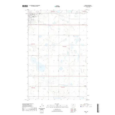
2020 Map of Rugby
USGS Topo · Published 2020About this map
Rugby serves as the regional hub of Pierce County, characterized by a grid-style urban layout that contrasts sharply with the surrounding prairie wetlands. The town's civic heart is marked by the Pierce County Courthouse, while the outskirts are punctuated by long-established sites such as Little Flower Cem. This landscape is defined by the unique prairie pothole geology of North Dakota, where numerous small, unnamed basins and wetlands dot the terrain around larger water bodies like Gunderson Lake. The map reveals a strictly organized section-line road network, including 66th St NE and 32nd Ave, which accommodates the natural distribution of water and agricultural land. Farther to the southeast, the Highland Lutheran Cem stands as a solitary landmark in the more sparsely settled reaches of the county.
Find a feature on this map
33 named features on this map. Tap any name to fly to it.
Don’t see what you’re looking for? This feature index may not catch every label — zoom into the map to look around manually.
Map Details
Editions of this 2020 Rugby Map
This is the sole edition of this map. No revisions or reprints were ever made.
Other maps of this area

1953 · Devils Lake
USGS Topo · 1:250,000

1954 · Tunbridge
USGS Topo · 1:24,000

1954 · Rugby NW
USGS Topo · 1:24,000

1954 · Leverich
USGS Topo · 1:24,000

1954 · Minot
USGS Topo · 1:250,000

1955 · Rugby
USGS Topo · 1:24,000

1956 · Devils Lake
USGS Topo · 1:250,000

1958 · Minot
USGS Topo · 1:250,000

1958 · Fillmore
USGS Topo · 1:24,000

1958 · Balta
USGS Topo · 1:24,000