2023 Map of Ruidoso
USGS Topo · Published 2023About this map
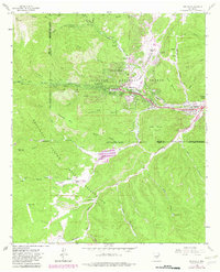
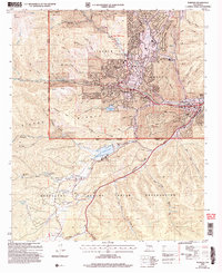
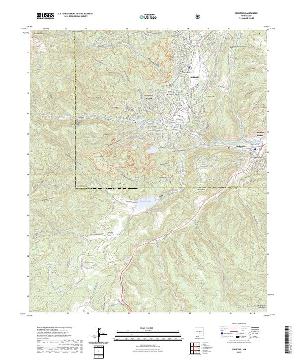
Ruidoso and its neighboring communities of Ponderosa Heights, Hollywood, and Ruidoso Downs are shown in detail as they sit within the sprawling canyons of the Lincoln National Forest. The geography is defined by sharp elevation changes, from the heights of Moon Mtn and Gavillan Ridge down to the Rio Ruidoso and the waters of Mescalero Lake. This survey illustrates the intricate network of mountain roads and trails, including Mechem Drive and Sequoia Dr, that connect these settlements. Local history is reflected in the numerous cemeteries such as Gavilan Memorial Gardens Cem and Pierce Canyon Cem, as well as the presence of Eastern New Mexico University - Ruidoso. The landscape is heavily dissected by named drainage features like Grindstone Canyon, Mine Canyon, and Sawmill Canyon, illustrating the complex terrain that characterizes this region of New Mexico near the border of Lincoln and Otero counties.
Find a feature on this map
193 named features on this map. Tap any name to fly to it.
Don’t see what you’re looking for? This feature index may not catch every label — zoom into the map to look around manually.
Map Details
Editions of this 2023 Ruidoso Map
This is the sole edition of this map. No revisions or reprints were ever made.
Historical Maps of Alpine Cellars Village Through Time
4 maps found