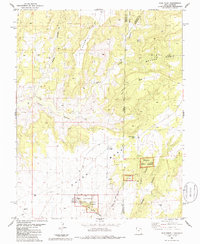
1985 Map of Ruin Point
USGS Topo · Published 1985About this map
Hovenweep National Monument preserves a complex landscape of ancestral sites along the border of Utah and Colorado, centered on the Square Tower Group Ruins. The rugged terrain of the Colorado Plateau is defined by deep incisions like Cross Canyon and Squaw Canyon, which drain the elevated Cajon Mesa. Human history is etched into the geography through the presence of a Cliff Dwelling, a Ranger Sta, and a designated Campground near Little Ruin Canyon. Beyond the archaeological protections, the map documents the region's 1980s industrial footprint with numerous Oil Wells and Drill Holes scattered across Mc Lean Basin and Squaw Point. Rare water sources, including Cajon Lake and several Springs, underscore the precarious nature of settlement in this arid high-desert environment.
Find a feature on this map
35 named features on this map. Tap any name to fly to it.
Don’t see what you’re looking for? This feature index may not catch every label — zoom into the map to look around manually.
Map Details
Editions of this 1985 Ruin Point Map
This is the sole edition of this map. No revisions or reprints were ever made.
Other maps of this area

1886 · Abajo
USGS Topo · 1:250,000

1892 · Abajo
USGS Topo · 1:250,000

1893 · Abajo
USGS Topo · 1:250,000

1955 · Verdure 4 SW
USGS Topo · 1:24,000

1956 · Cortez
USGS Topo · 1:250,000

1957 · Moqui NW
USGS Topo · 1:24,000

1957 · Aneth 1 NE
USGS Topo · 1:24,000

1957 · Cedar 3 SW
USGS Topo · 1:24,000

1957 · Aneth 1 NW
USGS Topo · 1:24,000

1957 · Moqui SW
USGS Topo · 1:24,000