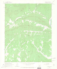
1964 Map of Rules Hill
USGS Topo · Published 1967About this map
The San Juan National Forest defines the character of this mid-century landscape, where high-altitude water systems and steep terrain intersect. The drainage of the West Fork Florida River and its various forks, including the North Fork Florida River and South Fork Florida River, dominate the western half of the sheet. Notable peaks and ridges such as Vosburg Pike and Rules Hill provide significant vertical relief, while Elks Park offers a rare break in the timbered slopes. Evidence of water management and transport is visible in the eastern section near the Los Pinos River, where the Sullivan Ditch and Texas Creek are mapped. These features, combined with the presence of multiple unnamed trails and jeep trails, illustrate a region used for recreation, forestry, and irrigation in the mid-1960s.
Find a feature on this map
23 named features on this map. Tap any name to fly to it.
Don’t see what you’re looking for? This feature index may not catch every label — zoom into the map to look around manually.
Map Details
Editions of this 1964 Rules Hill Map
3 editions found
Other maps of this area

1898 · Durango
USGS Topo · 1:62,500

1907 · Durango
USGS Topo · 1:62,500

1908 · Ignacio
USGS Topo · 1:125,000

1908 · Durango
USGS Topo · 1:62,500

1924 · Ignacio
USGS Topo · 1:125,000

1945 · Durango
USGS Topo · 1:250,000

1953 · Durango
USGS Topo · 1:250,000

1954 · Durango
USGS Topo · 1:250,000

1961 · Durango
USGS Topo · 1:250,000

1963 · Durango
USGS Topo · 1:250,000