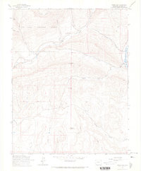
1964 Map of Rules Hill
USGS Topo · Published 1967About this map
The San Juan National Forest provides the backdrop for this mid-1960s study of the high-elevation terrain near the Los Pinos River. The landscape is defined by the convergence of several major waterways, including the North Fork and South Fork Florida Rivers, which carve through the mountains toward Elks Park. Notable for local researchers is the presence of the Shrock Cem near the headwaters of the Florida River, a distinct marker of early inhabitants in this mountainous region. Settlement is sparse, represented by the small community of Columbus and the topographic high points of Rules Hill and Rabbit Mountain. Evidence of early land management and transportation is found in the Sullivan Ditch and the Vosburg Pike, while numerous unnamed Jeep Trails snake across the canyons, indicating the area's continued use for resource management and backcountry access.
Find a feature on this map
26 named features on this map. Tap any name to fly to it.
Don’t see what you’re looking for? This feature index may not catch every label — zoom into the map to look around manually.
Map Details
Editions of this 1964 Rules Hill Map
3 editions found
Other maps of this area

1898 · Durango
USGS Topo · 1:62,500

1907 · Durango
USGS Topo · 1:62,500

1908 · Ignacio
USGS Topo · 1:125,000

1908 · Durango
USGS Topo · 1:62,500

1924 · Ignacio
USGS Topo · 1:125,000

1945 · Durango
USGS Topo · 1:250,000

1953 · Durango
USGS Topo · 1:250,000

1954 · Durango
USGS Topo · 1:250,000

1961 · Durango
USGS Topo · 1:250,000

1963 · Durango
USGS Topo · 1:250,000