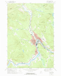
1969 Map of Rumford
USGS Topo · Published 1972About this map
The confluence of the Swift River and the Androscoggin River serves as the industrial heart of this region in the late 1960s. The bustling centers of Rumford and Mexico are shown in high detail, illustrating the dense residential blocks and industrial infrastructure surrounding the Rumford Falls Powerplant. Transportation networks are dominated by the Maine Central railroad and a grid of named streets including Porter Ave and Linnell St, which support the local mill and manufacturing economy. Outside the urban core, the landscape transitions to the steep slopes of Glass Face Mountain and North Twin Mtn. Local family history is preserved through numerous burial grounds like Sunnyside Cem and Farrington-Morton Cem, while community life is visible in the placement of several local schools and the Drive-in Theater along the river bend south of town.
Find a feature on this map
88 named features on this map. Tap any name to fly to it.
Don’t see what you’re looking for? This feature index may not catch every label — zoom into the map to look around manually.
Map Details
Editions of this 1969 Rumford Map
2 editions found
Other maps of this area

1911 · Bryant Pond
USGS Topo · 1:62,500

1911 · Buckfield
USGS Topo · 1:62,500

1913 · Buckfield
USGS Topo · 1:62,500

1914 · Bryant Pond
USGS Topo · 1:62,500

1926 · Dixfield
USGS Topo · 1:62,500

1927 · Rumford
USGS Topo · 1:48,000

1929 · Dixfield
USGS Topo · 1:62,500

1930 · Rumford
USGS Topo · 1:62,500

1942 · Buckfield
USGS Topo · 1:62,500

1942 · Bryant Pond
USGS Topo · 1:62,500