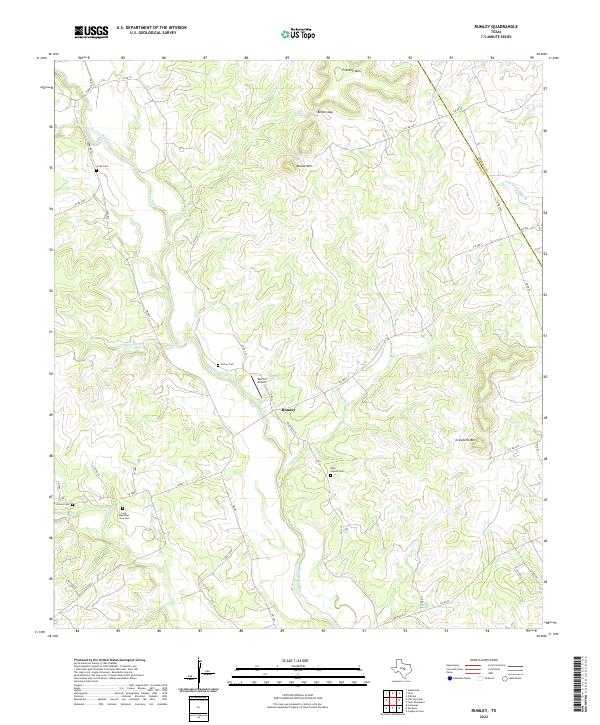
2022 Map of Rumley
USGS Topo · Published 2022About this map
Rumley sits as the central settlement in this Lampasas County landscape, where the Lampasas River and its numerous tributaries like Lucy Cr and Fall Cr carve through the Texas Hill Country. The terrain is defined by prominent elevations such as Franklin Mtn and Round Mtn, which overlook a network of rural roads including Farm Rd 1690 and FM 580 E. Genealogical value is found in the distribution of family-named burial sites across the ranching land, including Smith Cem, Garner Cem, and the uniquely named Long Meadows - Cox Cem. The presence of Worrell Airport and the crossing into Coryell County along the northeastern boundary show the modern connectivity and jurisdictional lines of this rural area. Historic landmarks like the Rock Church Cem highlight the community foundations established near the river's winding path.
Find a feature on this map
50 named features on this map. Tap any name to fly to it.
Don’t see what you’re looking for? This feature index may not catch every label — zoom into the map to look around manually.
Map Details
Editions of this 2022 Rumley Map
This is the sole edition of this map. No revisions or reprints were ever made.
Other maps of this area

1887 · Lampasas
USGS Topo · 1:125,000

1894 · Lampasas
USGS Topo · 1:125,000

1894 · Gatesville
USGS Topo · 1:125,000

1947 · Fort Hood
USGS Topo · 1:62,500

1947 · Purmela
USGS Topo · 1:62,500

1947 · Pidcoke
USGS Topo · 1:24,000

1947 · Twin Moutains
USGS Topo · 1:24,000

1947 · Copperas Cove
USGS Topo · 1:24,000

1954 · Brownwood
USGS Topo · 1:250,000

1954 · Evant
USGS Topo · 1:62,500