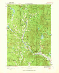
1928 Map of Rumney
USGS Topo · Published 1969About this map
The Baker River valley serves as the primary corridor for settlement and industry through these White Mountain foothills, anchored by the Boston and Maine Railroad. During the late 1920s, the economic landscape of the region was a mix of agriculture and extraction, evidenced by the Quarry near Warren and mining interests at Ore Hill. While many small settlements like Wentworth and Rumney grew along the rail line, more remote upland communities like North Dorchester and Cheever remained dependent on local roads.
Find a feature on this map
111 named features on this map. Tap any name to fly to it.
Don’t see what you’re looking for? This feature index may not catch every label — zoom into the map to look around manually.
Map Details
Editions of this 1928 Rumney Map
3 editions found
Other maps of this area

1925 · Holderness
USGS Topo · 1:62,500

1927 · Holderness
USGS Topo · 1:62,500

1927 · Cardigan
USGS Topo · 1:62,500

1927 · Mascoma
USGS Topo · 1:62,500

1928 · Plymouth
USGS Topo · 1:62,500

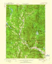
1928 · Rumney
USGS Topo · 1:62,500

1929 · Moosilauke
USGS Topo · 1:62,500

1929 · Franconia
USGS Topo · 1:62,500

1930 · Cardigan
USGS Topo · 1:62,500

1931 · Mt. Cube
USGS Topo · 1:62,500