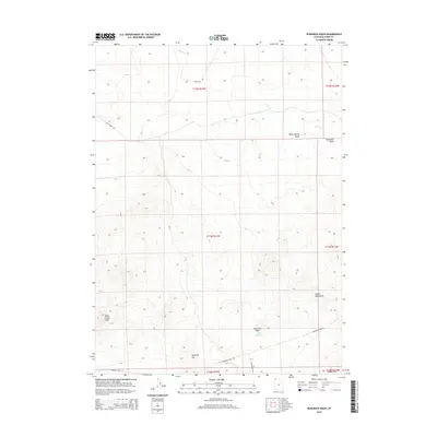
2014 Map of Runswick Wash
USGS Topo · Published 2014About this map
The Emigrant Trail Rd cuts across this high desert landscape in Box Elder County, tracing a path through a region defined by seasonal drainages and isolated peaks. Water management in this arid environment is evidenced by the Cliff Reservoir, which sits at the confluence of the Runswick Wash and smaller unnamed tributaries. The map details a transition between low-lying desert washes and several prominent rises, including the Matlin Mountains to the east and the Dove Creek Hills to the west.
Find a feature on this map
18 named features on this map. Tap any name to fly to it.
Don’t see what you’re looking for? This feature index may not catch every label — zoom into the map to look around manually.
Map Details
Editions of this 2014 Runswick Wash Map
This is the sole edition of this map. No revisions or reprints were ever made.
Other maps of this area

1954 · Brigham City
USGS Topo · 1:250,000

1958 · Brigham City
USGS Topo · 1:250,000

1959 · Park Valley
USGS Topo · 1:62,500

1959 · Yost
USGS Topo · 1:62,500

1962 · Brigham City
USGS Topo · 1:250,000

1971 · Prohibition Spring
USGS Topo · 1:24,000

1971 · Red Dome
USGS Topo · 1:24,000

1971 · Matlin
USGS Topo · 1:24,000
1971 · Runswick Wash
USGS Topo · 1:24,000

1971 · Warm Spring Hills
USGS Topo · 1:24,000