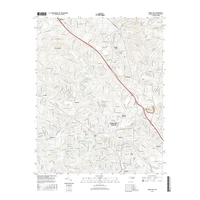
2016 Map of Rural Hall
USGS Topo · Published 2016About this map
Bethania and the northern suburban fringes of Winston-Salem define this Forsyth County landscape in the mid-2010s. The map illustrates a transition from the dense residential developments of Oak Crest and Reynolda near the Wake Forest University campus to the more open terrain of Tobaccoville and Pfafftown. Significant local history is preserved in the Numerous family-named burial grounds like Griffin Cem and Carmichael Cem, as well as the larger Forsyth Memorial Cem near Valley View. Drainage patterns across the area are characterized by the winding path of Muddy Creek and its many tributaries, while the topography rises toward Mountain Ridge in the northeast. The transport network reflects modern expansion, with major arteries connecting established settlements like Rural Hall and Stanleyville to the growing urban center.
Find a feature on this map
260 named features on this map. Tap any name to fly to it.
Don’t see what you’re looking for? This feature index may not catch every label — zoom into the map to look around manually.
Map Details
Editions of this 2016 Rural Hall Map
This is the sole edition of this map. No revisions or reprints were ever made.
Other maps of this area

1950 · Winston-Salem West
USGS Topo · 1:24,000

1950 · Winston-Salem East
USGS Topo · 1:24,000

1951 · Winston-Salem West
USGS Topo · 1:24,000

1951 · Winston-Salem East
USGS Topo · 1:24,000

1951 · Rural Hall
USGS Topo · 1:24,000

1951 · Walkertown
USGS Topo · 1:24,000

1953 · Winston-Salem
USGS Topo · 1:250,000

1955 · Winston-Salem
USGS Topo · 1:250,000

1962 · Winston-Salem
USGS Topo · 1:250,000

1964 · Pinnacle
USGS Topo · 1:24,000