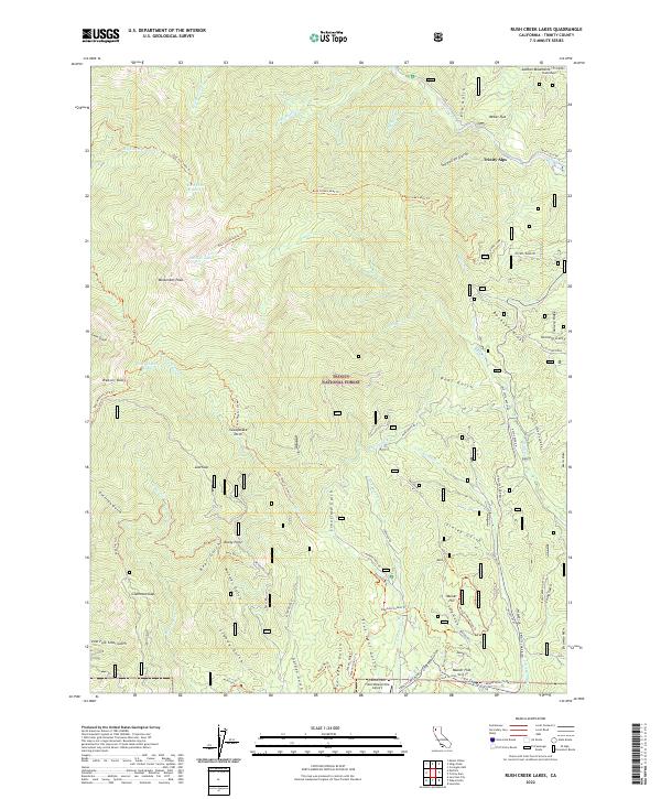
2022 Map of Rush Creek Lakes
USGS Topo · Published 2022About this map
Monument Peak and Weaver Bally anchor this high-elevation landscape in the Trinity National Forest, where the complex drainage systems of the Trinity Alps feed into the Weaver Creek watershed. The map details an extensive network of water management and resource history, including the Sweepstake Ditch and the Dolly Ditch Trl, which follow the contours of the steep gulches. Small-scale mountain settlements and clearings like Kinney Camp and Musser Flat appear alongside more modern infrastructure such as the Lonnie Pool Field/Weaverville Airport. High alpine water bodies, including Rush Creek Lakes and East Weaver Lake, are connected by a system of rugged trails like the Rush Creek Lakes Trl. Numerous named gulches, such as Five Cent Gulch and Ten Cent Gulch, suggest a landscape shaped by historical mining and prospecting activity.
Find a feature on this map
89 named features on this map. Tap any name to fly to it.
Don’t see what you’re looking for? This feature index may not catch every label — zoom into the map to look around manually.
Map Details
Editions of this 2022 Rush Creek Lakes Map
This is the sole edition of this map. No revisions or reprints were ever made.
Other maps of this area

1890 · Red Bluff
USGS Topo · 1:250,000

1894 · Red Bluff
USGS Topo · 1:250,000

1909 · Big Bar
USGS Topo · 1:96,000

1913 · Weaverville
USGS Topo · 1:125,000

1915 · Big Bar and Vicinity
USGS Topo · 1:250,000

1950 · Minersville
USGS Topo · 1:62,500

1950 · Weaverville
USGS Topo · 1:62,500

1951 · Hayfork
USGS Topo · 1:62,500

1951 · Helena
USGS Topo · 1:62,500

1952 · Weaverville
USGS Topo · 1:62,500