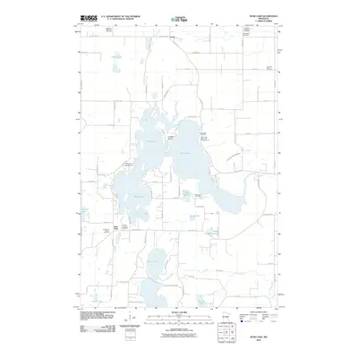
2010 Map of Rush Lake
USGS Topo · Published 2010About this map
Rush Lake and its intricate shoreline dominate this portion of Chisago County, providing a detailed look at the water-rich geography north of the Twin Cities. The area is characterized by a series of interconnected and adjacent water bodies, including Goose Lake, Pine Lake, and Round Lake, which are linked by Rush Creek and drainage systems like County Ditch Number Eight. The settlement patterns here are focused around small junctions such as Greely and Rush Point, with numerous cemeteries like Saint Johns Cemetery and West Rock Cemetery marking the long-standing community roots in the region.
Find a feature on this map
77 named features on this map. Tap any name to fly to it.
Don’t see what you’re looking for? This feature index may not catch every label — zoom into the map to look around manually.
Map Details
Editions of this 2010 Rush Lake Map
This is the sole edition of this map. No revisions or reprints were ever made.
Other maps of this area

1950 · Rush City
USGS Topo · 1:48,000

1953 · Stillwater
USGS Topo · 1:250,000

1955 · Rush City
USGS Topo · 1:62,500

1955 · Stillwater
USGS Topo · 1:250,000

1958 · Stillwater
USGS Topo · 1:250,000

1961 · Cambridge
USGS Topo · 1:62,500

1961 · Brook Park
USGS Topo · 1:62,500

1961 · Pine City
USGS Topo · 1:62,500

1965 · Stillwater
USGS Topo · 1:250,000

1975 · Stillwater
USGS Topo · 1:250,000