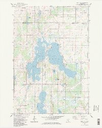
1983 Map of Rush Lake
USGS Topo · Published 1984About this map
Rush Lake dominates this portion of Chisago County, its irregular shoreline and islands shaped by the glacial legacy of east-central Minnesota. The map shows a landscape transitioning between agricultural fields and significant wetland systems, with La Belle Island and Pine Lake situated within the larger water body. Settlement is concentrated in small pockets such as Rush Point and the village of Harris, while the rural character is reinforced by a network of local roads like Back Hogs Road and several country cemeteries.
Find a feature on this map
33 named features on this map. Tap any name to fly to it.
Don’t see what you’re looking for? This feature index may not catch every label — zoom into the map to look around manually.
Map Details
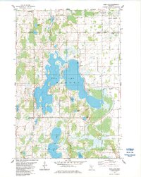
Editions of this 1983 Rush Lake Map
2 editions found
Other maps of this area

1950 · Rush City
USGS Topo · 1:48,000

1953 · Stillwater
USGS Topo · 1:250,000

1955 · Rush City
USGS Topo · 1:62,500

1955 · Stillwater
USGS Topo · 1:250,000

1958 · Stillwater
USGS Topo · 1:250,000

1961 · Cambridge
USGS Topo · 1:62,500

1961 · Brook Park
USGS Topo · 1:62,500

1961 · Pine City
USGS Topo · 1:62,500

1965 · Stillwater
USGS Topo · 1:250,000

1975 · Stillwater
USGS Topo · 1:250,000