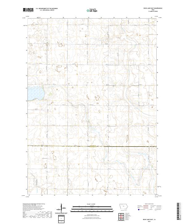
2022 Map of Rush Lake East
USGS Topo · Published 2022About this map
Rush Lake defines the western edge of this agricultural landscape in northwestern Iowa, where the headwaters of several critical prairie streams begin their descent. The terrain is a network of drainage and natural flow, with N Br Lizard Cr and Pilot Cr meandering through the strictly gridded section lines. This 2022 survey captures the modern rural infrastructure of the region, emphasizing the county-line division between Palo Alto Co and Pocahontas Co. The presence of Ditch Number 36 and the naming of Potato Farm Rd highlight the area's intensive land use and the systematic management of the water table to support the local agrarian economy. Collectors and researchers will find a clear record of the modern rural road network, from Co Hwy N28 to the numerous numbered avenues and streets that partition the township sections.
Find a feature on this map
38 named features on this map. Tap any name to fly to it.
Don’t see what you’re looking for? This feature index may not catch every label — zoom into the map to look around manually.
Map Details
Editions of this 2022 Rush Lake East Map
This is the sole edition of this map. No revisions or reprints were ever made.
Other maps of this area

1954 · Fairmont
USGS Topo · 1:250,000

1954 · Fort Dodge
USGS Topo · 1:250,000

1957 · Fort Dodge
USGS Topo · 1:250,000

1958 · Fort Dodge
USGS Topo · 1:250,000

1958 · Fairmont
USGS Topo · 1:250,000

1971 · Albert City
USGS Topo · 1:24,000

1971 · Rush Lake East
USGS Topo · 1:24,000

1971 · Rush Lake West
USGS Topo · 1:24,000

1971 · Laurens
USGS Topo · 1:24,000

1972 · Ayrshire
USGS Topo · 1:24,000