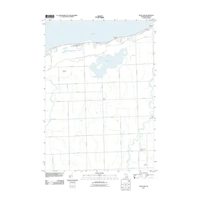
2011 Map of Rush Lake
USGS Topo · Published 2011About this map
The southern shoreline of Lake Huron defines this section of Huron County, where the sprawling Rush Lake lies just inland from the coast. The landscape transition from the sandy northern banks at Little Oak Point to the agricultural interior is marked by a grid of rural roads and watercourses like the Pigeon River and Pinnebog River. Notable for local historians and genealogists, the map identifies several distinct burial grounds, including Saint Felix Cemetery, Chandler Township Cemetery, and McKay Cemetery, providing precise locations for family research. Public lands and recreation areas are prominent along the coast, specifically at the Albert E Sleeper State Park Campground and several county parks including Oak Beach County Park. Small settlements like Gotts Corners anchor the rural intersections, while the meandering path of Bad Axe Creek cuts through the southeastern corner of the quadrangle.
Find a feature on this map
51 named features on this map. Tap any name to fly to it.
Don’t see what you’re looking for? This feature index may not catch every label — zoom into the map to look around manually.
Map Details
Editions of this 2011 Rush Lake Map
This is the sole edition of this map. No revisions or reprints were ever made.
Other maps of this area

1954 · Flint
USGS Topo · 1:250,000

1954 · Tawas City
USGS Topo · 1:250,000

1958 · Flint
USGS Topo · 1:250,000

1958 · Tawas City
USGS Topo · 1:250,000

1970 · Bay Port East
USGS Topo · 1:24,000

1970 · Caseville
USGS Topo · 1:24,000
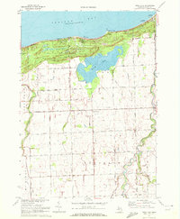
1970 · Rush Lake
USGS Topo · 1:24,000

1970 · Port Austin West
USGS Topo · 1:24,000

1970 · Kinde West
USGS Topo · 1:24,000

1970 · Bad Axe West
USGS Topo · 1:24,000