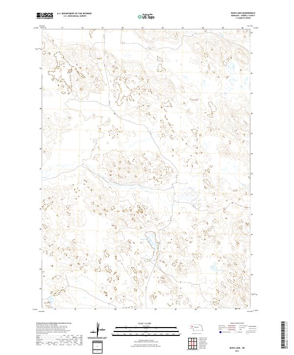
2021 Map of Rush Lake
USGS Topo · Published 2021About this map
Rush Lake and the nearby Carver Lake dominate the hydrography of this high plains landscape in Morrill County. The terrain is characterized by numerous small depressions and seasonal wetlands typical of the Nebraska Sandhills, a region defined more by its subtle topography and water catchment than by dense settlement. While no towns or established post offices appear within these boundaries, the grid of section lines and local routes such as RD 125 and RD 129 reflect the organized land management of the early 21st century. The map provides a clear look at the township and range divisions, including t23n r48w and t22n r47w, which are essential for property researchers and genealogists tracing land ownership in this rural section of the state.
Find a feature on this map
11 named features on this map. Tap any name to fly to it.
Don’t see what you’re looking for? This feature index may not catch every label — zoom into the map to look around manually.
Map Details
Editions of this 2021 Rush Lake Map
This is the sole edition of this map. No revisions or reprints were ever made.
Other maps of this area

1896 · Browns Creek
USGS Topo · 1:125,000

1899 · Browns Creek
USGS Topo · 1:125,000

1947 · Alliance
USGS Topo · 1:24,000

1947 · Bronco Lake
USGS Topo · 1:24,000

1948 · Alliance
USGS Topo · 1:24,000

1948 · Antioch
USGS Topo · 1:62,500

1949 · Lynn
USGS Topo · 1:62,500
1949 · Bronco Lake
USGS Topo · 1:24,000

1949 · Antioch
USGS Topo · 1:62,500

1950 · Storm Lake
USGS Topo · 1:62,500