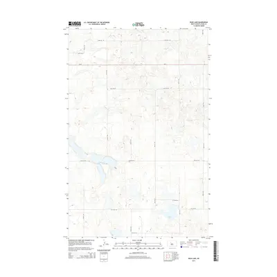
2014 Map of Rush Lake
USGS Topo · Published 2014About this map
Glacial depressions and prairie potholes define the landscape of Ward County in this modern survey, where water bodies like Rush Lake and Nelson and Carlson Lakes serve as the primary landmarks. The terrain is characterized by a high density of small, unnamed wetlands and ponds scattered across a grid of section-line roads. This area of North Dakota maintains a traditional rural structure, with connectivity provided by ND-23 running east-to-west across the northern portion of the quadrangle. Local travel relies on a network of named gravel and dirt routes, including 233RD Ave SW and 128TH St SW. The map illustrates a contemporary view of the region's hydrography, showing how local drainage patterns and water levels influence the placement of infrastructure in this agricultural and prairie environment.
Find a feature on this map
16 named features on this map. Tap any name to fly to it.
Don’t see what you’re looking for? This feature index may not catch every label — zoom into the map to look around manually.
Map Details
Editions of this 2014 Rush Lake Map
This is the sole edition of this map. No revisions or reprints were ever made.
Other maps of this area
1928 · Minot
USGS Topo · 1:62,500
1954 · Minot
USGS Topo · 1:250,000
1954 · McClusky
USGS Topo · 1:250,000
1956 · Douglas West
USGS Topo · 1:24,000
1958 · McClusky
USGS Topo · 1:250,000
1958 · Minot
USGS Topo · 1:250,000
1980 · Minot
USGS Topo · 1:100,000
1980 · Lake Vernon
USGS Topo · 1:24,000
1980 · South Prairie
USGS Topo · 1:24,000
1980 · Douglas East
USGS Topo · 1:24,000