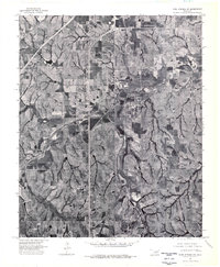
1975 Map of Rush Springs NW
USGS Topo · Published 1976About this map
Ninnekah sits at the heart of this mid-1970s orthophotograph, where the agricultural patterns of Grady County are captured in striking detail. The landscape is defined by the winding course of the Little Washita River, which snakes through the central and western portions of the quadrangle. This 1975 aerial survey by the U.S. Geological Survey provides a unique photographic record of land use and drainage patterns before modern digital mapping. The intersection of local rural life and regional transit is visible where the H E Bailey Turnpike cuts across the northwestern corner, contrasting the ancient meanders of the river with the straight lines of modern infrastructure. For those researching local property lines or environmental changes in central Oklahoma, these specific aerial views offer an exact visual baseline of the terrain as it existed during this era.
Find a feature on this map
3 named features on this map. Tap any name to fly to it.
Don’t see what you’re looking for? This feature index may not catch every label — zoom into the map to look around manually.
Map Details
Editions of this 1975 Rush Springs NW Map
This is the sole edition of this map. No revisions or reprints were ever made.
Other maps of this area

1902 · Rush Springs
USGS Topo · 1:125,000

1904 · Chickasha
USGS Topo · 1:125,000

1945 · Anadarko
USGS Topo · 1:62,500

1949 · Cement
USGS Topo · 1:62,500

1949 · Rush Springs
USGS Topo · 1:62,500

1950 · Rush Springs
USGS Topo · 1:62,500

1954 · Oklahoma City
USGS Topo · 1:250,000

1955 · Lawton
USGS Topo · 1:250,000

1955 · Clinton
USGS Topo · 1:250,000

1956 · Laverty
USGS Topo · 1:24,000