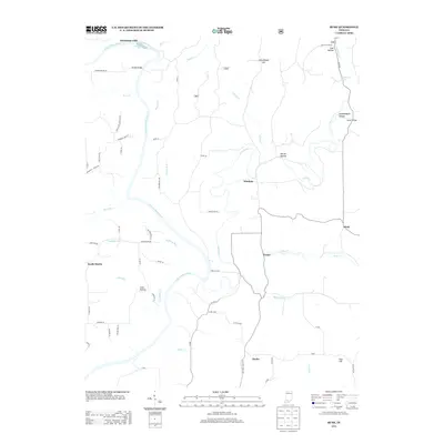
2013 Map of Rusk
USGS Topo · Published 2013About this map
The E Fork White River and the meandering path of the Lost River dominate this portion of Dubois County, where the landscape is defined by its complex drainage and localized hill terrain. This survey documents a rural environment punctuated by small named communities like Thales, Rusk, and Yenne, and the river crossing at Hindustan Falls. The presence of Schoolhouse Hill and several family-named roads, such as Huebner Farm Ln and Rutherford Rd, provides essential geographic markers for those tracing 21st-century property boundaries and local lineages. Smaller tributaries like Blue Cr and Hoffman Run weave between named hollows, including Harner Hollow and Coal Hollow, illustrating the deeply carved topography of the region. Local burial grounds are accessible via Holtsclaw Cemetery Ln and Wr Cemetery Rd, which serve as vital touchstones for family history researchers and local genealogists working in this Indiana countryside.
Find a feature on this map
68 named features on this map. Tap any name to fly to it.
Don’t see what you’re looking for? This feature index may not catch every label — zoom into the map to look around manually.
Map Details
Editions of this 2013 Rusk Map
This is the sole edition of this map. No revisions or reprints were ever made.
Other maps of this area

1946 · Jasper
USGS Topo · 1:24,000

1948 · Huron
USGS Topo · 1:24,000

1950 · Huron
USGS Topo · 1:24,000

1950 · Shoals
USGS Topo · 1:24,000

1951 · Hillham
USGS Topo · 1:24,000

1954 · Dubois
USGS Topo · 1:24,000

1956 · Alfordsville
USGS Topo · 1:24,000

1956 · Loogootee
USGS Topo · 1:24,000

1956 · Rusk
USGS Topo · 1:24,000

1956 · Vincennes
USGS Topo · 1:250,000