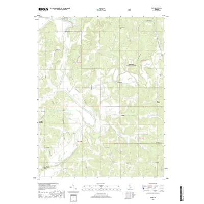
2019 Map of Rusk
USGS Topo · Published 2019About this map
Hindostan Falls and the winding course of the East Fork White River anchor this survey of the rugged borderlands between Martin and Dubois counties. The landscape is defined by its deep drainage networks, including Lost River, Blue Cr, and Simmons Cr, which carve through the dense timber of the Hoosier National Forest. Small, rural settlements like Thales, Yenne, Windom, and Rusk are connected by a web of narrow county roads, illustrating a classic Southern Indiana upland settlement pattern where communities formed around river crossings and forest clearings.
Find a feature on this map
78 named features on this map. Tap any name to fly to it.
Don’t see what you’re looking for? This feature index may not catch every label — zoom into the map to look around manually.
Map Details
Editions of this 2019 Rusk Map
This is the sole edition of this map. No revisions or reprints were ever made.
Other maps of this area

1946 · Jasper
USGS Topo · 1:24,000

1948 · Huron
USGS Topo · 1:24,000

1950 · Huron
USGS Topo · 1:24,000

1950 · Shoals
USGS Topo · 1:24,000

1951 · Hillham
USGS Topo · 1:24,000

1954 · Dubois
USGS Topo · 1:24,000

1956 · Alfordsville
USGS Topo · 1:24,000

1956 · Loogootee
USGS Topo · 1:24,000

1956 · Rusk
USGS Topo · 1:24,000

1956 · Vincennes
USGS Topo · 1:250,000