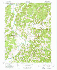
1978 Map of Rusk
USGS Topo · Published 1979About this map
Hindostan Falls marks a prominent point along the East Fork White River in this 1970s topographic study. The landscape is defined by the convergence of the White River and the Lost River, with the latter winding through the heart of the Hoosier National Forest. These waterways carved deep hollows and creek beds, such as Coon Hollow and Harner Hollow, which historically dictated the placement of small rural communities like Windom and Yenne.
Find a feature on this map
52 named features on this map. Tap any name to fly to it.
Don’t see what you’re looking for? This feature index may not catch every label — zoom into the map to look around manually.
Map Details
Editions of this 1978 Rusk Map
This is the sole edition of this map. No revisions or reprints were ever made.
Other maps of this area

1946 · Jasper
USGS Topo · 1:24,000

1948 · Huron
USGS Topo · 1:24,000

1950 · Huron
USGS Topo · 1:24,000

1950 · Shoals
USGS Topo · 1:24,000

1951 · Hillham
USGS Topo · 1:24,000

1954 · Dubois
USGS Topo · 1:24,000

1956 · Alfordsville
USGS Topo · 1:24,000

1956 · Loogootee
USGS Topo · 1:24,000

1956 · Rusk
USGS Topo · 1:24,000

1956 · Vincennes
USGS Topo · 1:250,000