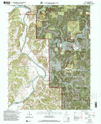
1993 Map of Rusk
USGS Topo · Published 2000About this map
Hindostan Falls and its adjacent public fishing site anchor the northern bend of the East Fork White River, a corridor defined by sharp limestone meanders and high vantage points like Schoolhouse Hill. This 1993 revision, based on older topography, shows the rural character of the Hoosier National Forest and the surrounding townships of Center, Halbert, and Rutherford. The map details the transition between open river valleys and the dense, hollow-cut terrain to the east, where labels like Harner Hollow and Coal Hollow trace the natural drainage patterns toward the Lost River. For those researching local heritage, the map identifies small community centers and rural landmarks such as Waggoner Chapel, Walker Cem, and the river crossings at Brooks Bridge and Butler Bridge.
Find a feature on this map
38 named features on this map. Tap any name to fly to it.
Don’t see what you’re looking for? This feature index may not catch every label — zoom into the map to look around manually.
Map Details
Editions of this 1993 Rusk Map
This is the sole edition of this map. No revisions or reprints were ever made.
Other maps of this area

1946 · Jasper
USGS Topo · 1:24,000

1948 · Huron
USGS Topo · 1:24,000

1950 · Huron
USGS Topo · 1:24,000

1950 · Shoals
USGS Topo · 1:24,000

1951 · Hillham
USGS Topo · 1:24,000

1954 · Dubois
USGS Topo · 1:24,000

1956 · Alfordsville
USGS Topo · 1:24,000

1956 · Loogootee
USGS Topo · 1:24,000

1956 · Rusk
USGS Topo · 1:24,000

1956 · Vincennes
USGS Topo · 1:250,000