1956 Map of Ruskin
USGS Topo · Published 1957About this map
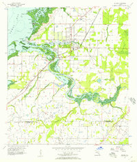
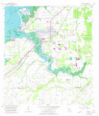
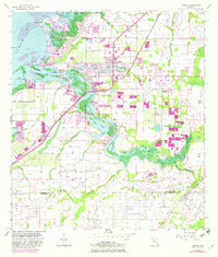
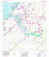
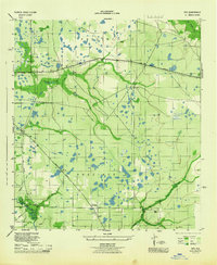
Ruskin serves as the central hub of this mid-1950s coastal survey, where the town's grid meets the tidal complexities of Tampa Bay. The landscape is defined by the winding course of the Little Manatee River and its numerous branches, including Mill Bayou, Hayes Bayou, and Bolster Bayou. To the west, a labyrinth of mangrove-lined islands like Goat Island, Negro Island, and Snake Island separate the mainland from the open bay waters.
Find a feature on this map
39 named features on this map. Tap any name to fly to it.
Don’t see what you’re looking for? This feature index may not catch every label — zoom into the map to look around manually.
Map Details
Editions of this 1956 Ruskin Map
4 editions found
Other maps of this area

1921 · Tampa
USGS Topo · 1:62,500

1921 · Fort De Soto
USGS Topo · 1:62,500

1921 · St Petersburg
USGS Topo · 1:62,500

1942 · Cockroach Bay
USGS Topo · 1:31,680

1943 · Port Tampa
USGS Topo · 1:31,680

1944 · Ruskin
USGS Topo · 1:31,680
1944 · Rye
USGS Topo · 1:31,680
1944 · Wimauma
USGS Topo · 1:31,680

1944 · Ellenton
USGS Topo · 1:31,680

1944 · Parish
USGS Topo · 1:31,680