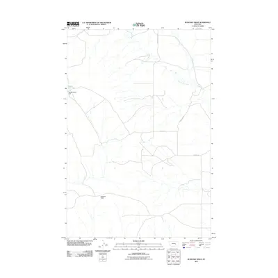
2011 Map of Ruskosky Ridge
USGS Topo · Published 2011About this map
Ruskosky Ridge stands as the defining topographic feature in this section of Rosebud County, shaping the drainage patterns and the path of the regional road network. This 2011 survey illustrates a sparse, ranch-oriented landscape where the presence of water is primarily indicated by West Muggins Creek and Muggins Creek. The upland terrain is characterized by broad plateaus such as Muggins Taylor Flat, which provide the foundation for a series of local thoroughfares. The road system, including S Sumatra Hysham Rd and Horse Camp Rd, reflects the low-density settlement of eastern Montana, where routes follow natural contours and link distant homesteads or ranching operations across the basin. For those studying the rural infrastructure of the early 21st century, the map provides a clear record of these essential arteries and the landforms that dictate their placement.
Find a feature on this map
7 named features on this map. Tap any name to fly to it.
Don’t see what you’re looking for? This feature index may not catch every label — zoom into the map to look around manually.
Map Details
Editions of this 2011 Ruskosky Ridge Map
This is the sole edition of this map. No revisions or reprints were ever made.
Other maps of this area

1954 · Forsyth
USGS Topo · 1:250,000

1957 · Forsyth
USGS Topo · 1:250,000

1958 · Forsyth
USGS Topo · 1:250,000

1960 · Rancher Cemetery
USGS Topo · 1:24,000

1960 · Ingomar West
USGS Topo · 1:24,000

1960 · Mc Konkey Creek
USGS Topo · 1:24,000

1962 · Guthridge Ranch
USGS Topo · 1:24,000

1962 · Sumatra
USGS Topo · 1:24,000

1979 · Melstone
USGS Topo · 1:100,000

1979 · Hysham
USGS Topo · 1:100,000