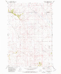
1980 Map of Ruskosky Ridge
USGS Topo · Published 1980About this map
Ruskosky Ridge serves as the central topographic feature in this section of eastern Montana, where the boundary between Rosebud Co and Treasure Co cuts through a landscape of expansive flats and deeply incised drainage channels. The area is defined by a complex network of ephemeral waterways, including Stove Coulee, Bone Coulee, and Sand Coulee, which draw down from the higher elevations of Taylor Flat. The distribution of scattered wells and occasional drill holes across the terrain suggests a quiet history of resource exploration and livestock management in this high plains environment. The northern reaches are drained by the headwaters of West Muggins Creek and Muggins Creek, illustrating the natural watershed patterns that have dictated land use and property boundaries in this rural Montana landscape.
Find a feature on this map
12 named features on this map. Tap any name to fly to it.
Don’t see what you’re looking for? This feature index may not catch every label — zoom into the map to look around manually.
Map Details
Editions of this 1980 Ruskosky Ridge Map
This is the sole edition of this map. No revisions or reprints were ever made.
Other maps of this area

1954 · Forsyth
USGS Topo · 1:250,000

1957 · Forsyth
USGS Topo · 1:250,000

1958 · Forsyth
USGS Topo · 1:250,000

1960 · Rancher Cemetery
USGS Topo · 1:24,000

1960 · Ingomar West
USGS Topo · 1:24,000

1960 · Mc Konkey Creek
USGS Topo · 1:24,000

1962 · Guthridge Ranch
USGS Topo · 1:24,000

1962 · Sumatra
USGS Topo · 1:24,000

1979 · Melstone
USGS Topo · 1:100,000

1979 · Hysham
USGS Topo · 1:100,000