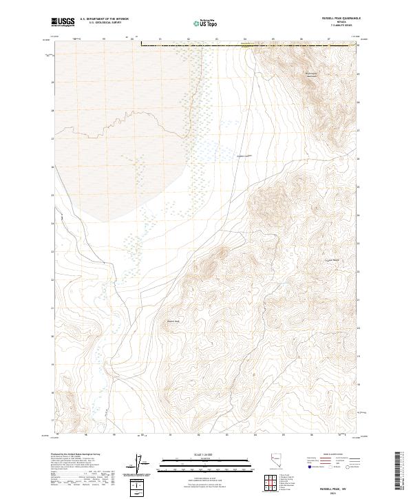
2021 Map of Russell Peak
USGS Topo · Published 2021About this map
Russell Peak stands as the central landmark of this high-desert terrain where the western slopes of the Nightingale Mountains meet the northern reaches of the Truckee Range. The landscape is defined by its arid isolation, bridged only by the winding path of Valley Rd in the southwest and the remote crossing of the Pershing Co / Washoe Co boundary line. In an environment dominated by steep ridges and dry basins, isolated water sources like Coyel Spring and the drainage of Coyote Canyon were critical points of orientation for early surveyors and travelers navigating this section of Nevada. The topography shown here emphasizes the intricate drainage patterns and elevation changes that dictated the early paths and land use throughout the Great Basin.
Find a feature on this map
7 named features on this map. Tap any name to fly to it.
Don’t see what you’re looking for? This feature index may not catch every label — zoom into the map to look around manually.
Map Details
Editions of this 2021 Russell Peak Map
This is the sole edition of this map. No revisions or reprints were ever made.
Other maps of this area

1886 · Granite Range
USGS Topo · 1:250,000

1890 · Wadsworth
USGS Topo · 1:125,000

1892 · Wadsworth
USGS Topo · 1:125,000

1894 · Granite Range
USGS Topo · 1:250,000

1894 · Wadsworth
USGS Topo · 1:125,000

1955 · Lovelock
USGS Topo · 1:250,000

1957 · Fireball Ridge
USGS Topo · 1:62,500

1957 · Nixon
USGS Topo · 1:62,500

1957 · Reno
USGS Topo · 1:250,000

1959 · Lovelock
USGS Topo · 1:250,000