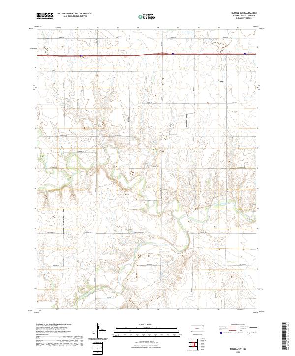
2022 Map of Russell SW
USGS Topo · Published 2022About this map
The Smoky Hill River meanders across the southern landscape of this Russell County quadrangle, defining the local geography alongside several significant tributaries. Tributaries such as Big Cr and Walker Cr carve through the terrain, illustrating the drainage patterns that have historically shaped land use in this part of Kansas. The infrastructure of the early 21st century is marked by the presence of I- 70 Rd running through the northern sections, while a grid of local corridors like Balta Galatia Rd and Lincoln Rd provide access to the rural acreage. These road names, including Homer Rd and Grant Rd, often reflect the family names and early community nodes that once anchored the township. While primarily rural, the arrangement of section lines and water crossings provides a clear look at the agricultural distribution and water access points north of the Smoky Hill valley.
Find a feature on this map
31 named features on this map. Tap any name to fly to it.
Don’t see what you’re looking for? This feature index may not catch every label — zoom into the map to look around manually.
Map Details
Editions of this 2022 Russell SW Map
This is the sole edition of this map. No revisions or reprints were ever made.
Other maps of this area

1896 · Russell
USGS Topo · 1:125,000

1896 · Hays
USGS Topo · 1:125,000

1955 · Great Bend
USGS Topo · 1:250,000

1957 · Great Bend
USGS Topo · 1:250,000

1958 · Great Bend
USGS Topo · 1:250,000
1961 · Walker
USGS Topo · 1:24,000

1961 · Russell SW
USGS Topo · 1:24,000

1961 · Homer
USGS Topo · 1:24,000

1967 · Russell NW
USGS Topo · 1:24,000

1967 · Russell
USGS Topo · 1:24,000