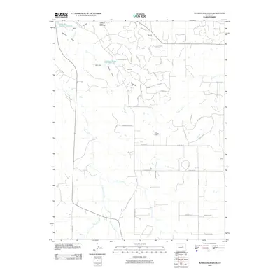
2010 Map of Russellville Gulch
USGS Topo · Published 2010About this map
Russellville and Cimarron anchor this portrait of the Colorado landscape as it transitioned into the early twenty-first century. The map reveals a complex drainage network where Cherry Creek meets its tributaries, West Cherry Creek and East Cherry Creek, carving through the varied terrain of Wildcat Canyon and Russellville Gulch. The intersection of historical extraction and modern utility is evident in the presence of the R E Coulter Mine and the Jenny Lode, standing alongside water management infrastructure like the Franktown Parker FPR-1 Dam. Transportation patterns here are particularly evocative of the American West, featuring a mix of local routes such as Anderson Rd and trails with historical resonances like the Chisholm Trl. Small-scale aviation is represented by the Kostroski Airport, while family-named landmarks like Reed and the Barney Bird Reservoir Number 1 provide valuable data for local genealogists.
Find a feature on this map
57 named features on this map. Tap any name to fly to it.
Don’t see what you’re looking for? This feature index may not catch every label — zoom into the map to look around manually.
Map Details
Editions of this 2010 Russellville Gulch Map
This is the sole edition of this map. No revisions or reprints were ever made.
Other maps of this area

1894 · Castle Rock
USGS Topo · 1:125,000

1913 · Castle Rock
USGS Topo · 1:125,000

1939 · Elizabeth
USGS Topo · 1:62,500

1940 · Elbert
USGS Topo · 1:62,500

1940 · Castle Rock
USGS Topo · 1:62,500

1944 · Elbert
USGS Topo · 1:62,500

1945 · Castle Rock
USGS Topo · 1:62,500

1945 · Elizabeth
USGS Topo · 1:62,500

1953 · Denver
USGS Topo · 1:250,000

1954 · Cherry Valley School
USGS Topo · 1:24,000