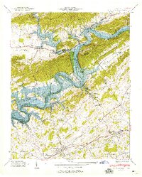
1939 Map of Russellville
USGS Topo · Published 1958About this map
The Holston River carves a winding path through this East Tennessee landscape, its waters backing up into the newly formed Lake Cherokee during this 1939 survey. The map details a transition in the valley as the rising lake levels interact with established river features like Cobb Shoals and islands such as Watermelon Island and Bingham Island. To the south, the Southern railroad and the Lee Highway anchor the commerce of Russellville and Whitesburg, where local industry is represented by Cain Mill and several quarries.
Find a feature on this map
72 named features on this map. Tap any name to fly to it.
Don’t see what you’re looking for? This feature index may not catch every label — zoom into the map to look around manually.
Map Details
Editions of this 1939 Russellville Map
This is the sole edition of this map. No revisions or reprints were ever made.
Other maps of this area

1883 · Morristown
USGS Topo · 1:125,000

1893 · Morristown
USGS Topo · 1:125,000

1895 · Morristown
USGS Topo · 1:125,000

1935 · Rogersville
USGS Topo · 1:48,000

1935 · Tate Springs
USGS Topo · 1:48,000

1935 · Lee Valley
USGS Topo · 1:24,000

1935 · Springvale
USGS Topo · 1:24,000

1935 · Swan Island
USGS Topo · 1:24,000

1935 · Morristown
USGS Topo · 1:24,000

1935 · Russellville
USGS Topo · 1:24,000