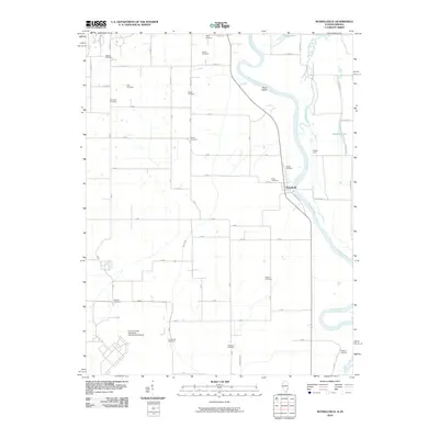
2010 Map of Russellville
USGS Topo · Published 2010About this map
The Wabash River meanders along the border of Illinois and Indiana, defining the eastern edge of this landscape where the village of Russellville sits near a prominent river bend. This 2010 topographic record highlights a region characterized by carefully managed drainage and agricultural history, visible through features like Niblack Levee, Taylor Ditch, and Ditch Number 2. The sheer number of family-named burial grounds across the quadrangle, including Higgins Cemetery, Tobey Cemetery, and Ferrell Cemetery, suggests a long-established rural community with deep genealogical roots. To the southwest, the modern infrastructure of the Lawrenceville-Vincennes International Airport provides a sharp contrast to the natural curves of Old Busseron Creek and the river islands like Swan Island. This map serves as an essential tool for tracing local history, documenting both the legacy of early settlers and the engineering of the river valley.
Find a feature on this map
69 named features on this map. Tap any name to fly to it.
Don’t see what you’re looking for? This feature index may not catch every label — zoom into the map to look around manually.
Map Details
Editions of this 2010 Russellville Map
This is the sole edition of this map. No revisions or reprints were ever made.
Other maps of this area

1915 · Vincennes
USGS Topo · 1:62,500

1917 · Birds
USGS Topo · 1:62,500

1942 · Fritchton
USGS Topo · 1:24,000

1942 · Birds
USGS Topo · 1:62,500

1943 · Carlisle
USGS Topo · 1:24,000

1943 · Oaktown
USGS Topo · 1:24,000

1944 · Fritchton
USGS Topo · 1:24,000

1944 · Vincennes
USGS Topo · 1:62,500

1956 · Vincennes
USGS Topo · 1:250,000

1957 · Vincennes
USGS Topo · 1:250,000