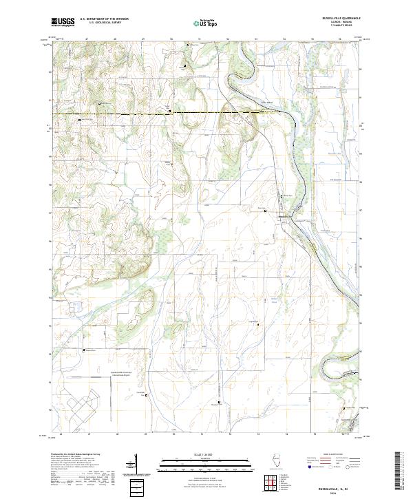
2024 Map of Russellville
USGS Topo · Published 2024About this map
The Wabash River meanders along the Illinois-Indiana state line, defining the eastern border of this landscape dominated by riverine features and agricultural drainage. At the center of this geography lies Russellville, a riverbank community where Water St and Harrison St meet near the Russellville Crossing Rd. The river's influence is evident in the presence of Swan Island and Sevenmile Island, as well as numerous oxbows and managed waterways like Taylor Ditch and Otter Pond Ditch.
Find a feature on this map
48 named features on this map. Tap any name to fly to it.
Don’t see what you’re looking for? This feature index may not catch every label — zoom into the map to look around manually.
Map Details
Editions of this 2024 Russellville Map
This is the sole edition of this map. No revisions or reprints were ever made.
Other maps of this area

1915 · Vincennes
USGS Topo · 1:62,500

1917 · Birds
USGS Topo · 1:62,500

1942 · Fritchton
USGS Topo · 1:24,000

1942 · Birds
USGS Topo · 1:62,500

1943 · Carlisle
USGS Topo · 1:24,000

1943 · Oaktown
USGS Topo · 1:24,000

1944 · Fritchton
USGS Topo · 1:24,000

1944 · Vincennes
USGS Topo · 1:62,500

1956 · Vincennes
USGS Topo · 1:250,000

1957 · Vincennes
USGS Topo · 1:250,000