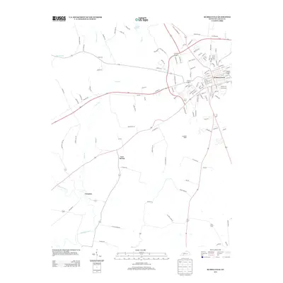
2013 Map of Russellville
USGS Topo · Published 2013About this map
Russellville serves as the focal point of this Logan County landscape, where the urban grid of the city meets the rolling farmland of southern Kentucky. The terrain is defined by a network of waterways including Whippoorwill Creek, Barren Fork, and Dry Fork, which drain the area surrounding the prominent Luckett Knob. To the west, smaller settlements like Cave Springs and Ferguson are connected by rural routes that follow the natural topography of the region. Local history is anchored by landmarks such as the Doyle Cemetery and Lake Herndon, providing specific points of interest for genealogists tracing family roots in the area. The map illustrates a developed transportation network with numerous named rural roads, such as Milton Sharpe Road and Buena Vista Road, which highlight the long-standing agricultural and residential patterns of the county.
Find a feature on this map
121 named features on this map. Tap any name to fly to it.
Don’t see what you’re looking for? This feature index may not catch every label — zoom into the map to look around manually.
Map Details
Editions of this 2013 Russellville Map
This is the sole edition of this map. No revisions or reprints were ever made.
Other maps of this area

1950 · Allensville
USGS Topo · 1:24,000

1950 · Olmstead
USGS Topo · 1:24,000

1951 · Olmstead
USGS Topo · 1:24,000

1951 · Adairville
USGS Topo · 1:24,000

1951 · Dot
USGS Topo · 1:24,000

1951 · Lewisburg
USGS Topo · 1:24,000

1951 · Homer
USGS Topo · 1:24,000

1952 · Russellville
USGS Topo · 1:24,000

1952 · Sharon Grove
USGS Topo · 1:24,000

1952 · Dennis
USGS Topo · 1:24,000