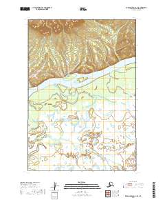
2019 Map of Russian Mission C-1 SE
USGS Topo · Published 2019About this map
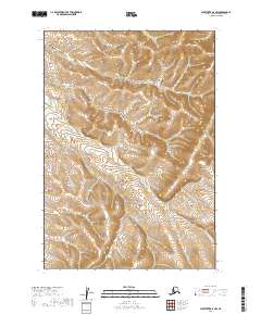
The Kuskokwim River dominates this landscape in the Bethel Census Area, winding through a complex network of wetlands and seasonal floodplains. This 2019 survey captures the river's path as it braids through the southwestern Alaskan wilderness, showing the intricate hydrological patterns of the region. To the south, Doestock Cr meanders through the low-lying marshlands, reflecting a terrain defined by water and shifting alluvial deposits. The map provides a detailed view of the Public Land Survey System grid, demarcating townships such as t17n r54w and t18n r55w. This area is characterized by significant topographic relief in the northern sections, where elevations rise sharply above the river valley, offering a clear contrast between the high ground and the saturated river bottomlands typical of this part of the Alaska interior.
Find a feature on this map
8 named features on this map. Tap any name to fly to it.
Don’t see what you’re looking for? This feature index may not catch every label — zoom into the map to look around manually.
Map Details
Editions of this 2019 Russian Mission C-1 SE Map
This is the sole edition of this map. No revisions or reprints were ever made.
Other maps of this area

1947 · Russian Mission
USGS Topo · 1:250,000

1950 · Russian Mission
USGS Topo · 1:250,000

1950 · Sleetmute
USGS Topo · 1:250,000

1952 · Russian Mission C-1
USGS Topo · 1:63,360
1952 · Russian Mission B-1
USGS Topo · 1:63,360
1954 · Sleetmute C-8
USGS Topo · 1:63,360

1954 · Sleetmute
USGS Topo · 1:250,000
1954 · Sleetmute B-8
USGS Topo · 1:63,360

1980 · Russian Mission
USGS Topo · 1:250,000
2019 · Sleetmute B-8 NW
USGS Topo · 1:25,000