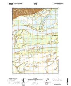
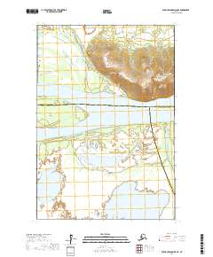
2017 Map of Russian Mission D-5 NW
USGS Topo · Published 2017About this map
Yukon River dominates the center of this landscape, carving a wide path through the western Alaska wilderness. The river splits around Pearl Island, a large landmass within the channel, while the northern terrain rises into the Ilivit Mountains. This particular area serves as a jurisdictional boundary point, where the Yukon-Koyukuk Census Area meets the Kusilvak Census Area. The intricate network of waterways is further defined by Tuckers Slough, which meanders through the lowlands north of the main river channel. Named geographical landmarks like Peters Point and Para Point provide navigational reference along the riverbanks, marking the shifting edges of this delta-like environment where water and land are constantly in flux.
Find a feature on this map
11 named features on this map. Tap any name to fly to it.
Don’t see what you’re looking for? This feature index may not catch every label — zoom into the map to look around manually.
Map Details
Editions of this 2017 Russian Mission D-5 NW Map
This is the sole edition of this map. No revisions or reprints were ever made.
Other maps of this area

1947 · Russian Mission
USGS Topo · 1:250,000

1950 · Russian Mission
USGS Topo · 1:250,000

1951 · Holy Cross
USGS Topo · 1:250,000

1952 · Holy Cross A-4
USGS Topo · 1:63,360

1952 · Holy Cross
USGS Topo · 1:250,000
1952 · Russian Mission D-6
USGS Topo · 1:63,360
1952 · Russian Mission D-5
USGS Topo · 1:63,360

1980 · Russian Mission
USGS Topo · 1:250,000
2017 · Russian Mission D-5 SE
USGS Topo · 1:25,000
2017 · Russian Mission D-5 NE
USGS Topo · 1:25,000