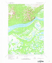
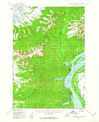
1952 Map of Russian Mission D-6
USGS Topo · Published 1962About this map
The Yukon River dominates this mid-century landscape as it cuts through the Ilvit Mountains, creating a complex network of seasonal watercourses and shifting banks. Along the northern shore, the Winter Trail connects seasonal sites such as Dogfish Village and Tuckers Fish Camp, illustrating the specialized riverine economy of the era. The terrain shifts from the high elevations of Mount Chiniklik and Mount Ewaklalik to the low, braided wetlands surrounding Tuckers Slough. To the south, the Talboksok River meanders toward the settlement of Talboksok, showing a vast expanse of delta-like terrain. This 1952 record, based on 1951 aerial photography, documents the subsistence landscape before modern infrastructure, where travel was dictated by the river's flow and the seasonal freezing of the tundra.
Find a feature on this map
13 named features on this map. Tap any name to fly to it.
Don’t see what you’re looking for? This feature index may not catch every label — zoom into the map to look around manually.
Map Details
Editions of this 1952 Russian Mission D-6 Map
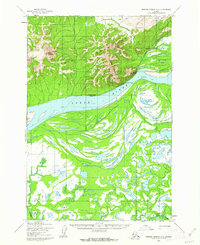
2 editions found
Other maps of this area

1947 · Russian Mission
USGS Topo · 1:250,000

1950 · Russian Mission
USGS Topo · 1:250,000

1951 · Holy Cross
USGS Topo · 1:250,000

1951 · Holy Cross A-5
USGS Topo · 1:63,360

1952 · Holy Cross A-4
USGS Topo · 1:63,360

1952 · Holy Cross
USGS Topo · 1:250,000
1952 · Russian Mission C-7
USGS Topo · 1:63,360

1952 · Russian Mission C-5
USGS Topo · 1:63,360
1952 · Russian Mission D-5
USGS Topo · 1:63,360
1952 · Russian Mission D-7
USGS Topo · 1:63,360